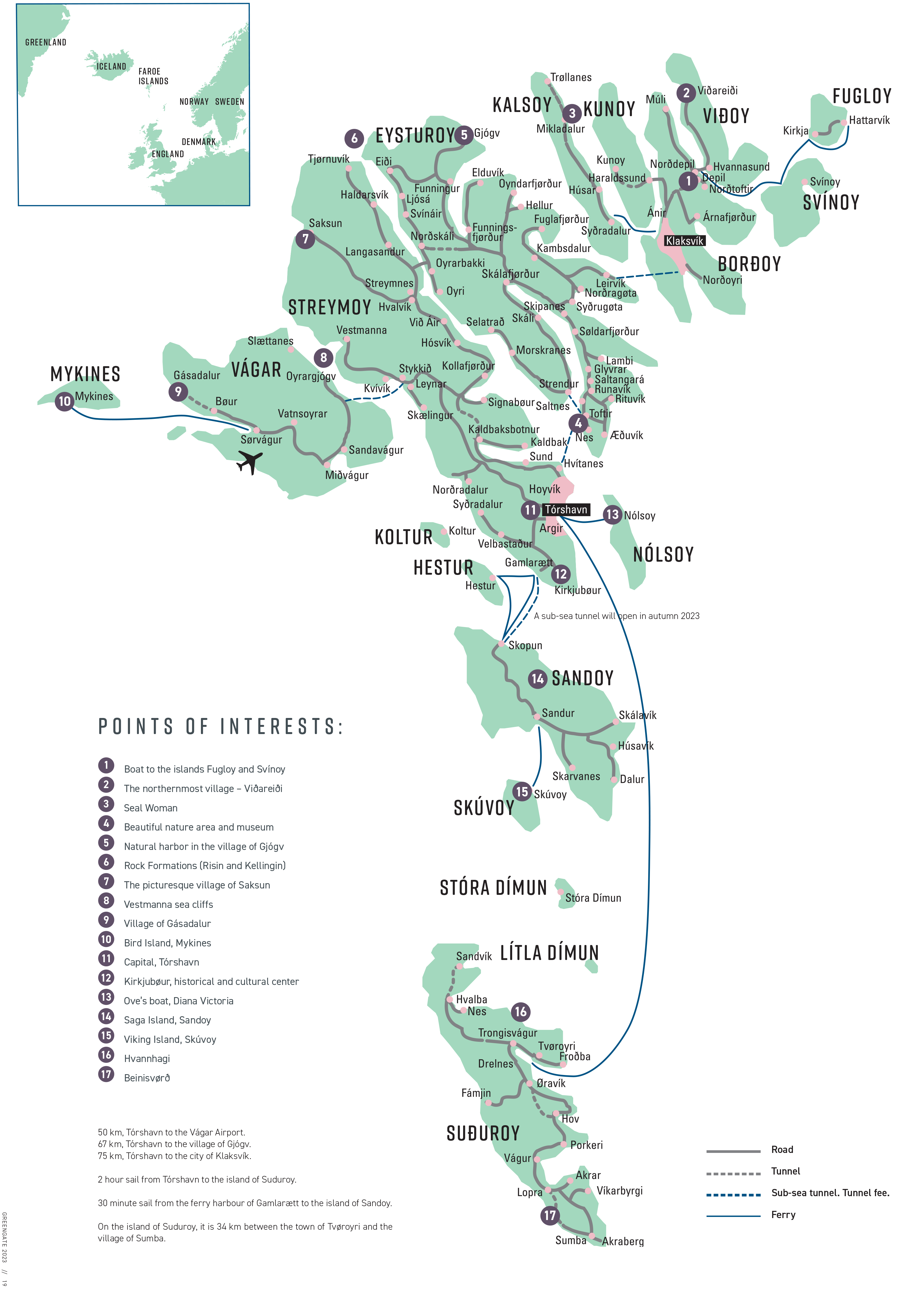
Faroe Islands map
Situated in the North Atlantic Ocean only two hours by plane from mainland Europe the 18 mountainous islands of the Faroe Islands offer 1,289 kilometers of coastline and a proximity of no more than five kilometers to the ocean from any point of the islands.
The close proximity provides the visitor with a variety of experiences of nature – from dramatic landscapes meeting the wild ocean to the peacefulness of the mountains to the nightlife of the capital Tórshavn.
Although the Faroe Islands are located at 62 degrees N the climate in the Faroe Islands is surprisingly mild due to the Gulf Stream. The average temperature in the warmest months is 13°C resulting is mild summer days and during the winther the average temperature is 3°C.
Visitors during the summer are taken aback by the characteristic long days and the light nights. In the middle of the summer the sun hardly sets and the longest day is 19½ hours long. This gives the visitors ample opportunities to enjoy the long and light evenings adding a special feel to the visit to the Faroe Islands.
Another characteristic with the Faroese climate and which really facinates foreigners is the constantly changing wheather. One of the most common feedbacks from tourists is the uniqueness of experiencing all four seasons within the same day.